
Find free camping on public lands with these mapping tools
Premium Members can read the entire article here:
This is an updated version of an article I published 5-ish years ago.
There are lots of reasons why you may want to see public lands on a map (along with your position). Here are a few.
Personally, I use public lands overlays mostly to find free camping, so that's going to be the main focus of this article. Car camping can be great. Secluded car camping for FREE on public lands that allow it is even better!
You’re headed out for a dawn start for a hike or climb, and want to find a good spot near the trailhead to sleep for the night.
You want to visit a popular national park, but of course all the campsites in the park are booked. Where could you camp for free just outside the park and visit for day use?
You’ve embraced some version of “van life”, and never want to pay if it all possible when you're sleeping in your rig.
You're planning a hunting or fishing trip and want to be sure you don't trespass.
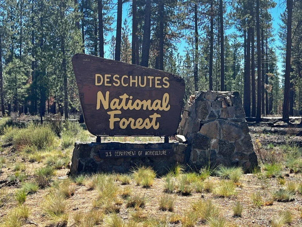
On main roads, you might see a nice welcome sign like this. But on many smaller roads, you won't.
For the most part, land managed by the Bureau of Land Management (BLM), and the US Forest Service, (USFS), allow free camping pretty much anywhere unless posted otherwise.
This applies if you don't need amenities like a gravel parking pad, running water, picnic table and a toilet. (The government-speak term for this is “dispersed camping”. RV folks might call it “boondocking”. )
This policy also mostly applies to state owned forest land in Oregon, owned by the Oregon Department of Forestry, or ODF, and in Washington, on land owned by Washington Department of Natural Resources, or DNR. Other USA states may have a similar system.
But, sometimes it’s hard to know whether you’re actually on public land that allows free camping, or not.
Good news is, there’s some good desktop mapping software and phone apps that can answer the question, hopefully leading you to a secluded, free overnight spot with no hassles.
Notes . . .
As cartographers like to say, ”the map is not the territory.” Meaning, what’s really on the ground is the truth, not the printed map or phone app in your hand. If the map says you’re on public land, but the sign on the tree says “area closed” no trespassing, or there are some grumpy locals who are giving you bad vibes, use your common sense and move on.
Leave No Trace principles of course apply. Is this obvious? I sure hope so. Don’t camp in meadows, near waterways or other fragile areas, leave zero garbage, toilet paper or fire rings behind, be VERY careful with campfires (if you even choose to have one) and observe all rules regarding fire closures, which are common in the summer. Have a walk around and pick up somebody else's trash before you leave.
When using a phone app, be sure and download your area of interest when you have Wi-Fi or cell coverage before you get out of cell coverage.
Rural gas station attendants are often great sources for good free campsites. A small tip offered for your gas before asking can work wonders. =^)
Desktop: Caltopo
For this example, let's look for possible camping spots near the Crater Lake National Park in southern Oregon.
Go to CalTopo.com, my favorite backcountry mapping software, and zoom into your area of interest; here’s Crater Lake NP. Choose a map layer. I like “Mapbuilder Topo”, the default.
Then, mouse over the map layer menu in the top right corner, and check the box next to “Land Management”, under the “Map Overlays” section.

Now, your map should look something like this. Note the clear boundary between the National Park land around the lake, and the green tinted National Forest lands around the park.

Now we’re talking! Look at all those logging roads (in the red box) just outside the main road that leads into the park from the west, all on National Forest land. Most of these should offer some decent, free dispersed camping options, just a few minutes away from the park boundary.

Here’s one more. This is just outside the main entrance station at the southwest corner of Mt. Rainier National Park. Check out those roads on the green Forest Service land; looks like a good place to camp for free and then go into the park the next day.

Phone apps - Gaia GPS “Public Lands” overlay
Phone based apps of course have the big advantage of showing your real time location AND the land ownership around you. Here are two that I like.
On the “professional version” of the app, which is $40 a year, Gaia GPS has a map overlay option called “Public Land US”. With the “pro” version, Gaia has an advantage of being able to adjust the opacity of the map layers with a slider bar, which can be a big help in seeing smaller roads and pull outs.
Below is a map legend for Gaia GPS that shows the different public lands layers.

Here we have the map layers “USFS 2016” and “Public Land (US)”. We see a brownish tint for the National Park, and a green tint for the surrounding Forest Service land.

Zooming into the same area where the main western access road enters the park, we see all of the forest service roads, many of which should offer some good camping options.

Phone apps - Gaia GPS “Gaia Topo” free map layer
Recently, a GaiaGPS made some significant upgrades to their primary map layer, called “Gaia Topo”. (One great thing about this layer, it's free, both on the desktop and on your phone.) One of these improvements is showing public lands right on the map. Here's an example around Mt Rainier. (Please ignore the waypoints and climbing routes on the map.)
The subtle shading on this map shows different types of public lands.
Along the main road Hwy 706 coming into the park, you pass through State Forest lands, shown in light purple.
South of the park is light green, which is National Forest.
Slightly darker green is a designated wilderness area (no roads or car camping there).
Finally, the light brownish orange is the National Park itself. Note, there is no dispersed camping allowed in national parks, but the State Forest and US Forest land should be fair game. Note there are lots of roads in both these areas; you need to zoom in more on the map to see them.

Gaia GPS Public lands example using Gaia GPS topo
Want to see my suggestion for an up-and-coming phone app with a great public lands layer?
How about the GPS coordinates for my go-to free camping area right outside Yosemite National Park?
