
Here’s a link to a CalTopo map that has GPX files of some of the major long distance hiking routes in the Pacific Northwest:
Ptarmigan Traverse
Around Mt. Hood
Around Mt. Adams
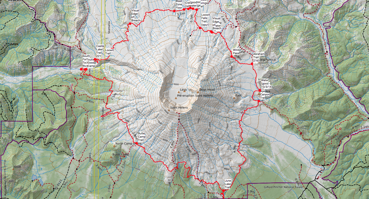
Around Mt. Saint Helens
Around Mt. Rainier
Note:
Some of these routes, especially the Ptarmigan Traverse, require advanced mountaineering skills and route finding abilities.
The east side of Mount Adams is on the Yakama Indian reservation and access might be limited.
You can download this GPX file from CalTopo by clicking “Export > Download GPX File”, and save it to your computer.
You can also print maps from CalTopo the with the print function, and add additional pages as needed to cover your entire route with the green plus sign “add page” in the bottom left corner. Orient the map page to portrait or landscape. Be patient; maps can take a few minutes to generate, especially multi-page maps.