
Google Earth is great.
Seeing your route on it is even better.
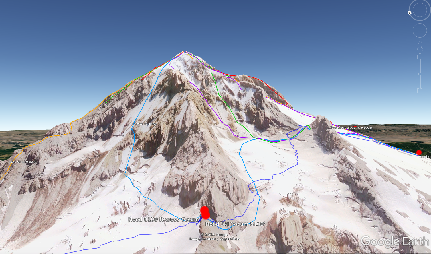
Google Earth is a fantastic tool for visualizing the terrain for your next outdoor adventure. When you have a GPX track drawn on it, it’s even more useful!
I offer you two options for viewing Pacific NW climbing routes in Google Earth:
The files are hosted on a shared Google Drive. It’s a KML (Keyhole Markup Language, in case you had to know) file.
Here’s how to view the KML file in Google Earth:
If you don’t already have it, download Google Earth to your computer.
Click the link above. It should open Google Drive in a new browser tab. Click the “Download” icon in the top right corner to save the KML file to your hard drive.
Double click the downloaded KML file to open in Google Earth.
See all the routes in full Google Earth majesty, and enjoy your 3-D zoom and pan, fly-around super powers.
It's more than eye candy.
Scope the route at home to get familiar with it.
Print out screen grabs to take along with you.
Save screen grabs on your phone for reference when you’re climbing.
Check this article to learn some Google Earth screen grab tricks.