
Alpine Tips

Have a “plan B” for climbs - bring an extra guidebook
Toss that extra guide book in your car before a trip, case you need to suddenly change objectives.
There are many reasons why a climb may not “go”, from the route being too dry or too wet/snowy, wildfire closures, getting lost on the approach, or being attacked at base camp by a well organized gang of rock rodents.
So the weekend isn’t a total bust, consider bringing a guidebook or two for other nearby hikes or climbs in case the main destination doesn’t work out. If the primary climb goes, the guidebook stays in the car. That way, you may be able to enjoy an alternative destination, and still be able to salvage the trip. This becomes even more important with high gas prices and the longer a trip is from your home!
You can of course bring a physical guidebook. Or, it might be more convenient for you to buy a guidebook or two in Kindle format, and just keep that loaded onto your phone so it's always there.

Is there a wildfire near my climb? Check here
Use this great website to see all of the active wildfires in the Western US. Check this before you leave home in the summer - don’t let a distant fire shut down your trip.
A few years back, I was heading out the door out to try the West Ridge of Mt. Stuart in central Washington - an area notorious for summer fires. As we rolled out the driveway, I had a sudden thought. “Hey, I’m going back in and check for fires, I think I heard something on the news,” I said.
Sure enough, a call to the local US Forest Service office told me a fire had started the day before near the trailhead and all backcountry access was closed. If we hadn’t checked, we would have driven 5 hours for nothing. Even if a fire may be far away from your destination, the land management agency still may decide to close a big area. Don’t let this ruin your weekend, always call first!
Here are three websites and phone apps that can give you the most current fire information: 1) CalTopo, 2) Gaia GPS, and 3) Inciweb.
1 - CalTopo “Fire Activity” map overlay
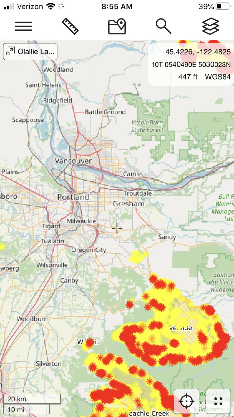
From the always awesome CalTopo, click on the map overlay “Fire Activity”. The fire data come from a variety of sources, typically satellite-based. It shows where the active fronts of the fire (red and orange) are, which can be more useful than simply seeing the area that's been burned. This is my new go-to for active fire info. You can read more details at the CalTopo website.
This works on both CalTopo platforms, desktop and phone app. Plus, it's free! (Fire maps below from Sept 2020.)

Here's what it looks like on the CalTopo phone app. Tap the “map layer” icon in the top right corner, and check the box next to “fire activity” to add this overlay to your chosen base layer, here Open Street Map.
2 - Gaia GPS
Gaia GPS is a good place to check, because in addition to fire coverage, it shows smoke coverage forecasts which can be helpful also. It takes a few clicks, but follow the steps below and you'll have it set up in a minute or so.
Go to gaiagps.com. If you don’t have an account, make one for free. (Normally Gaia offers weather information like this only to Premium level subscribers, but to their credit, they make fire and smoke maps free to everyone, thanks Gaia!)
1 - Click “Layers” on the left side menu.

2 - Click “Add Map Layers”

3 - Click the “Weather” icon.

4 - Select anything in the purple boxes you want to see by clicking the green “plus” icon to add it to your map.

Click the back button. Toggle on the layer you want to see. Here's the 24 hour smoke forecast, yuck (July 24. 2021)

Here’s is the current Air Quality map. (Yikes, let's not go to North Central Washington this weekend.)

Finally, here’s the current wildfires map layer.

3 - InciWeb
InciWeb is the “Incident information system” for active wildfires throughout the west. You can click on each icon for more detailed information about each fire, such as the location, the lead agency fighting it, start date, how big it is, containment percentage, and expected date of containment. It also has links about campground, road and land closures.
A screen grab from Sept 2020, a major fire year:
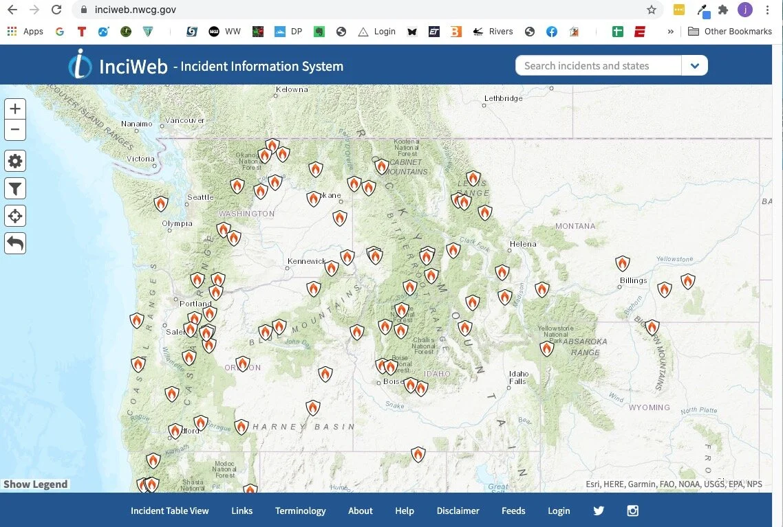
If you click on a fire icon, it brings up more specific information about that fire. If you scroll down the page a bit, there are some easy to miss tabs they can give you helpful info like evacuation announcements, area or trailhead closures, photographs, and more.


Bring a backup map as a PDF file
If you already have a PDF file of a map that you’ve made in Caltopo or other mapping software, why not save a copy to your phone? It’s free, fast and weighs 0.00 grams.
With modern mapping software such as Caltopo, it’s easier than ever to procure or make a PDF file of a good quality map. While you should of course have a printed map with you, why not also have a copy of the PDF on your phone?
(In addition to a map, you can take photos or scans of guidebook pages, or even an entire guidebook as a PDF file, if it's available. Or, you can really go for it and maybe purchase an entire guide book in Kindle format, and keep that on your phone as well.)
The map is free, a PDF file does not “weigh” anything, and it takes just a minute to add it to your phone. Having a backup copy of the map on your phone can be handy if your paper map is lost or destroyed, and it lets you share it with someone on your hike or climb who perhaps did not bring one. You can pan and zoom, and with a good pdf, be able to see even fine map detail.
Android people, I'm not sure about you, but there are several ways to view a PDF file on your iPhone. Here’s how I do it.
Save or download the map to your hard drive.
Email it to yourself and open the email on your phone with the native iPhone email app (not Gmail, Outlook, etc).
Tap the email to download the PDF, this should take a just couple of seconds.
Do a long touch on the PDF file. A window should open that gives different way to view or save it. I use the native iPhone “iBooks) app.
Tap “Open in iBooks”, and the pdf should open for viewing in iBooks.
Below - example .pdf map made in Caltopo of the Adams Glacier route, Mt Adams, WA. (This is a screen grab, the actual PDF file has a better resolution than this.)


Google maps pro tip - Full 3D in satellite view
Want to make Google Maps act like Google Earth, and view the whole world in fly around 3-D satellite view? Here's how to do it.
Here’s a very cool yet little known function in Google maps - Satellite view 3-D fly around, which makes Google maps behave pretty much like Google Earth. This is great for scoping out your next backcountry adventure. Super simple, here's how to do it.
(Open Google maps up a new browser tab and give it a try!)
Zoom into your favorite mountain in Google maps.
Change to satellite view by clicking the satellite icon in the lower left corner. (Yes, it still looks pretty useless, but wait, it gets better!)
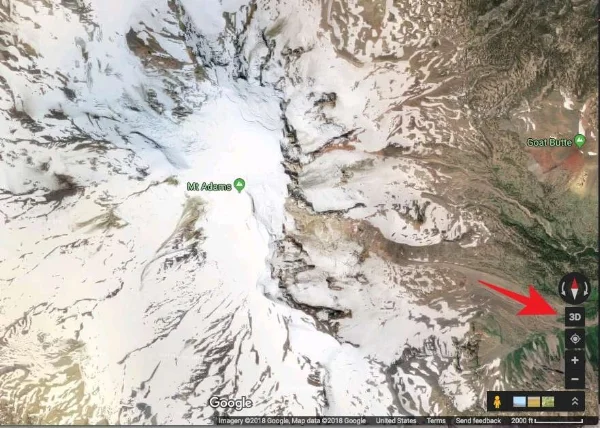
Click the “3D” button in the lower right corner.
Hold down the control key on your keyboard, and left click and drag.
Use the scroll wheel on your mouse to zoom in and out. (Yes, a mouse with a scroll wheel is a big help here.)
This gives you complete 3-D viewing. Click the 2-D button to go back into "direct overhead" view.
Before this feature, the only way you could do this was to zoom around in Google Earth, which takes longer to load and has a bit of a learning curve to effectively fly around.
Mt. Adams (WA) in 2D Google maps, standard view, YAWN!
Mt. Adams in 2D Google maps, satellite view. More useful! Click "3D" in the lower right.
Now we're cooking! Zoom and pan around the mountain like Google Earth, to see the satellite view in 3-D.
